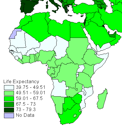
A Choropleth map is a form of thematic map that uses shading or pattering to portray an feature of an area. These maps provide an easy way to view a form of data about a place. This map very clearly shows the differences in life expectancy across Africa.
No comments:
Post a Comment